GISCAN
L'Intelligence Géographique à votre service




Discover GISCAN
GISCAN ltd is a start-up specialised in Geographic Information Systems (GIS). High-Tech and open-source driven, GISCAN brought together, experts from different fields to develop innovative and tailor-made solutions for clients in different sectors.
GISCAN provides decision-making tools through analytical and technical surveys and assist companies in setting up consistent solutions in a timely manner.
ACCURACY, HIGH RESOLUTION, SPATIAL ANALYSIS, GIS
OUR CORE BUSINESS
Leverage your data
- Value your data through GIS and develop real decision-making tools.
- Effective implementation of GIS solutions.
- Manage your GIS internally or externally via our secured online webmapping platform. A virtual environment to interact, explore, create and share GIS data to enhance knowledge and productivity.
Spatial and Temporal Analysis
Our data acquisition process is not limited to raw data or producing orthophotos. We go further :
- Quantification of agricultural damage,
- Risk simulation (flooding, landslides, etc.),
- Analysis of crop production,
- Automated counting of plants (example: vineyards)
- Generating Digital Surface model based on Digital Terrain model
- Volume calculation
- Assessment of element’s height (Buildings, Trees …) Comparison and analysis with spatial evolutions over several years,
- Sequential analysis and comparison of spatial data evolution
- Object detection
Custom GIS Application
Implementation of personalised GIS applications based on the needs of each client.
OUR TECHNOLOGIES

Powerful Algorithms
GISCAN provides key solutions based on latest technologies to meet specific needs of clients within limited time frames.
Well-versed in programming, GISCAN team develops its own algorithms to automate processes and personalise GIS applications.

High Performance method of Calculation
GISCAN possesses powerful workstations to support GIS, photogrammetric and webmapping processes.
GISCANs’ multiple servers are housed at different development institutions worldwide to ensure high availability, high security and performance.

Open Source
GISCAN Ltd is opensource oriented. It promotes opensource software in all its work processes and embraces principles of open exchange, collaborative participation, rapid prototyping, transparency and community-oriented development.
GISCAN team actively participates in open source projects within its fields (GIS, Linux, software drone, hardware drone, GPS)
Our company is a member of Open Source Geospatial Foundation (OSGEO)

Drone
GISCAN has a small yet efficient fleet of UAV (drone and planes) to meet each and every demand. Design and engineering development are carried out in-house. Our engineers pay much attention to flight time limitations at each conception phase – thus, ensuring flight duration of 30 minutes to hours.
MISSIONS
Geographical Intelligence at your service
Bring out the best of your data to leverage your company’s objectives
Research, Know-How, Consulting
Personalised Support and Technical Assistance

Data Acquisition
REFERENCES
RECENT PROJECTS
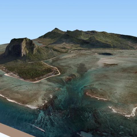
3D model of mountain Le Morne in Mauritius
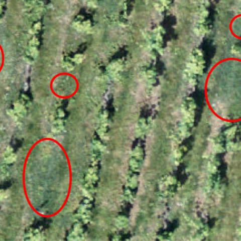
Viticulture: automated counting of vines
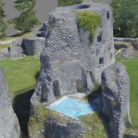
3D Model from drone data
BIG DATA : Mapping a Town of 33km² with a drone
GISCAN © 2015 - 2021
