Training
About our courses
The courses proposed by GISCAN are designed to fit user’s expectations. Flexible and tailored to meet your needs, the courses enable you to explore and investigate the power of maps and spatial data to improve your interpretation and analysis of data and enhance your data reading.Discover further the Geographical Information Systems (GIS) world and enlarge your scope of work by applying GIS principles and tools. Get started?
Want to discover GIS?Want to easily and quickly handle GIS without getting into their complexities?GISCAN offers a one-day introductory course to Geographical Information Systems.
More information!
You are a professional, you use GIS in your field, but it is not your core business.GISCAN offers an intermediary course for those who want to deepen their knowledge of GIS methods and tools.
For more information
You are a GIS expert and you want to update your knowledge or master specific skills;GISCAN offers advanced course and shares with you its knowledge and competence of new GIS tools developed by the team.
For more information
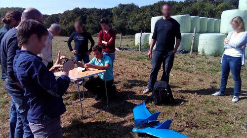
Some of the specific trainings among others are: Imagery, Point Clouds, Webmapping, GPS, UAV, Mobile GIS. GISCAN offers personalized training to adapt your expectations.
Contact Us !
![]()
![]()
![]()
![]()

![]()